Description
 Go beyond tracking weather
Analyze trends to create understanding
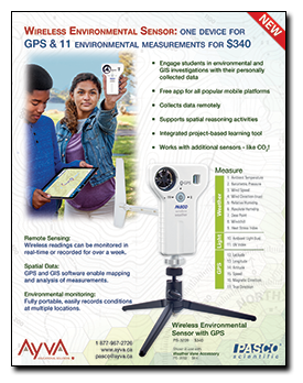
The Wireless Weather Sensor with GPS is an all-in-one instrument for monitoring environmental conditions. A built-in anemometer as well as sensing elements for temperature, humidity, pressure, light, and GPS the sensor provides up to 17 different measurements that can be used individually or simultaneously.
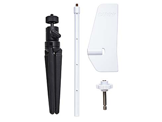
Use the sensor in logging mode with the optional Weather Vane Accessory for long-term monitoring, or use it as a hand-held instrument to study microclimates and record ambient conditions relevant to many biological and environmental phenomena.
Conduct GIS/mapping experiments using the onboard GPS sensor in conjunction with any of the other available measurements. The new map display in PASCO software provides a way for students to analyze spatial data.
Best of all, even with the versatility and functionality available, the Wireless Weather Sensor with GPS is simple and intuitive for students to use.
Note: The anemometer can only be used in winds at or below the max speed rating. Using it in hurricane level winds or with a leaf blower can damage the unit.
Available Measurements:
Weather |
1 |
Ambient Temperature |
|
2 |
Barometric Pressure |
|
|
3 |
Wind Speed |
|
|
4 |
Wind Direction (true) |
|
|
5 |
Relative Humidity |
|
|
6 |
Absolute Humidity |
|
|
7 |
Dew Point |
|
|
8 |
Windchill |
|
|
9 |
Heat Stress Index |
|
Light |
10 |
Ambient Light (lux) |
|
11 |
UV Index |
|
GPS |
12 |
Latitude |
|
13 |
Longitude |
|
|
14 |
Altitude |
|
|
15 |
Speed |
|
|
16 |
Magnetic Direction |
|
|
17 |
True Direction |
Typical Applications:
- Conduct weather sensor experiments by collecting long term weather data
- Study wind and pressure changes as a storm approaches
- GIS and mapping activities
- Investigate microclimates
- Provide spatial information for mapping other sensor data
Special Features:
- Logging mode for long term experiments
- Water resistant for extended environmental monitoring
- Built-in light sensor for measuring light level and UV index
- New map display (in PASCO software) for analyzing spatial data
- 17 different measurements that can be collected and analyzed individually or simultaneously.
Specifications:
| Barometric Pressure |
|
| Ambient Temperature |
|
| Wind Speed |
|
| Directional measurement |
|
| Relative Humidity |
|
| Illuminance (light level) |
|
| UV Index |
|
| Altitude (via GPS) |
|
| Speed (via GPS) |
|
| Connectivity |
|
| Battery |
|
| Data Logging |
|
| Water-resistance |
|
| Operating Environment |
|
| Calculated measurements |
|
| GPS |
|